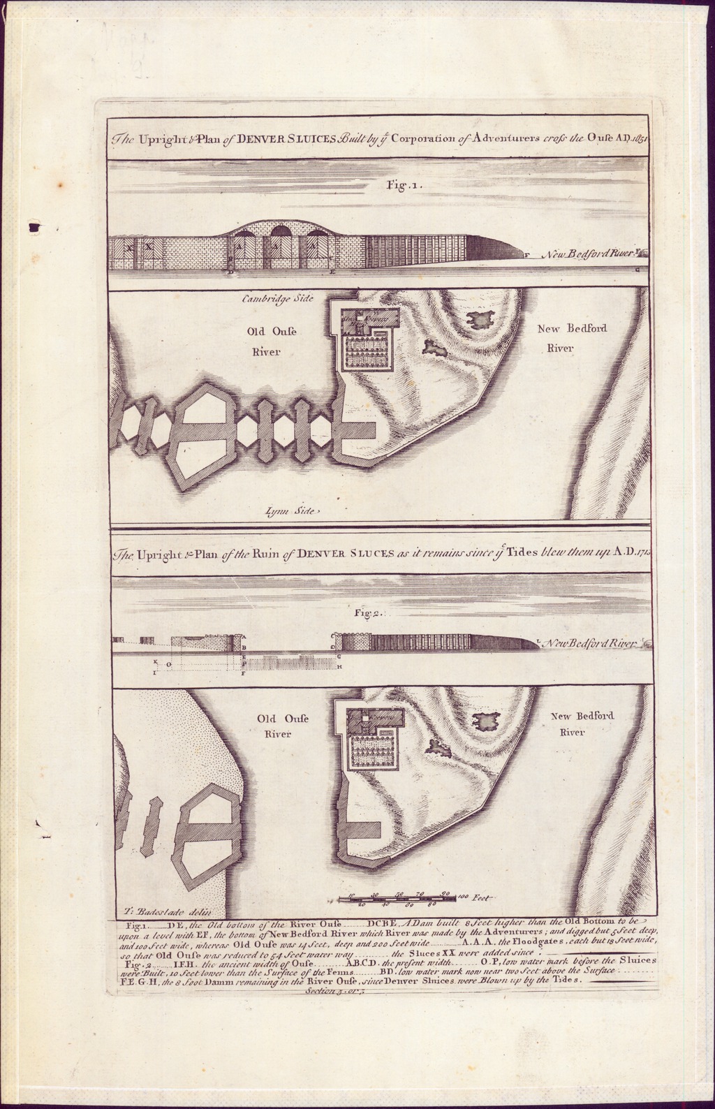
The Upright & Plan of DENVER SLUICES Built by ye Corporation of Adventurers cross the Ouse AD. 1651
The Upright & Plan of the Ruin of DENVER SLUCES as it remains since ye Tides blew them up A.D. 1713
| dc.contributor | Parker, Samuel (metsző) | |
| dc.contributor | Badeslade, Thomas (aktív 1712-1745) (kész. és közread.) | |
| dc.coverage.spatial | [1:760] 100 feet [= 40 mm] | |
| dc.coverage.spatial | Great Ouse | |
| dc.date.accessioned | 2016-05-12T23:00:49Z | |
| dc.date.available | 2016-05-12T23:00:49Z | |
| dc.date.copyright | 1725 | |
| dc.date.issued | 1725 | |
| dc.identifier.uri | https://ds.oszk.hu/xmlui/handle/123456789/51537 | |
| dc.description | A közép-angliai Great Ouse folyón 1651-ben, Denver település mellett épített zsilip és annak 1713. évi állapota, 1-1 keresztmetszettel | |
| dc.description | A két térkép és a két keresztmetszet együttes mérete címfeliratokkal: 27,8x18,6 cm | |
| dc.description | Megjelenési adatok és a metsző külső források alapján | |
| dc.format.extent | 1 térkl., 2 társtérkép | |
| dc.format.medium | rézmetszet | |
| dc.format.medium | 8x18,6 cm | |
| dc.publisher | [printed by J. Roberts, for the author] | |
| dc.title | The Upright & Plan of DENVER SLUICES Built by ye Corporation of Adventurers cross the Ouse AD. 1651 | |
| dc.title | The Upright & Plan of the Ruin of DENVER SLUCES as it remains since ye Tides blew them up A.D. 1713 | |
| dc.title.alternative | Great Ouse (Denver-i szakasz) (vízrendezési térkép) (1651, 1713) | |
| dc.type | Cartographic | |
| dc.type | vízrajzi térkép | |
| dc.type | vízrendezési térkép | |
| dc.publication | [London] : [printed by J. Roberts, for the author], [1725] | |
| dc.identifier.collection | OSZK-2755584 | |
| dc.identifier.location | TR 376 |