| dc.contributor | Badeslade, Thomas (aktív 1712-1745) (kész. és közreadó) | |
| dc.contributor | Parker, Samuel (metsző) | |
| dc.contributor | Hayward, William (alapján) | |
| dc.coverage.spatial | [1:210 000] A Scale of Miles, 10 [= 78 mm] | |
| dc.coverage.spatial | The Fens | |
| dc.date.accessioned | 2016-03-11T19:34:25Z | |
| dc.date.available | 2016-03-11T19:34:25Z | |
| dc.date.copyright | 1725 | |
| dc.date.issued | 1725 | |
| dc.identifier.uri | https://ds.oszk.hu/xmlui/handle/123456789/93792 | |
| dc.description | Fokhálózat nélkül | |
| dc.description | Nyugati tájolás, irányrózsával | |
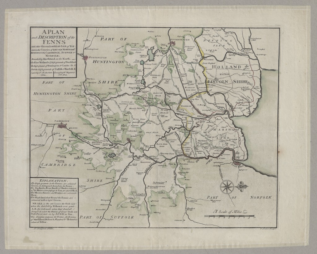
| dc.description | A kelet-angliai The Fenns mocsárvidék W. Hayward: A Generall Plotte and description of the Fennes and other Grounds within ye isle of Ely c. 1604-ben készült kéziratos térképének másolata | |
| dc.description | Teljes méret a kereten kívüli feliratokkal, a lemezhatárig: 32,2x39,8 cm | |
| dc.description | Megjelenési adatai külső források alapján | |
| dc.format.extent | 1 térkl. | |
| dc.format.medium | rézmetszet, kézi szín. | |
| dc.format.medium | 31,5x39 cm | |
| dc.publisher | [T. Badeslade] | |
| dc.title | A PLAN and DESCRIPTION of the FENNS and other Grounds within the ISLE of ELY. and in the Counties of LINCOLN NORDHAMP : HUNTINGTON, CAMBRIDGE, SUFFOLK & NORFOLK. | |
| dc.title.alternative | The Fens (vízrendezési térkép) (1604) | |
| dc.type | Cartographic | |
| dc.type | vízrendezési térkép | |
| dc.type | topográfiai térkép | |
| dc.publication | [London] : [T. Badeslade], [1725] ([printed by J. Roberts, for the author] | |
| dc.identifier.collection | OSZK-2755315 | |
| dc.identifier.location | TR 1 037 | |