| dc.contributor | Badeslade, Thomas (aktív 1712-1745) (kész. és közreadó) | |
| dc.contributor | Parker, Samuel (metsző) | |
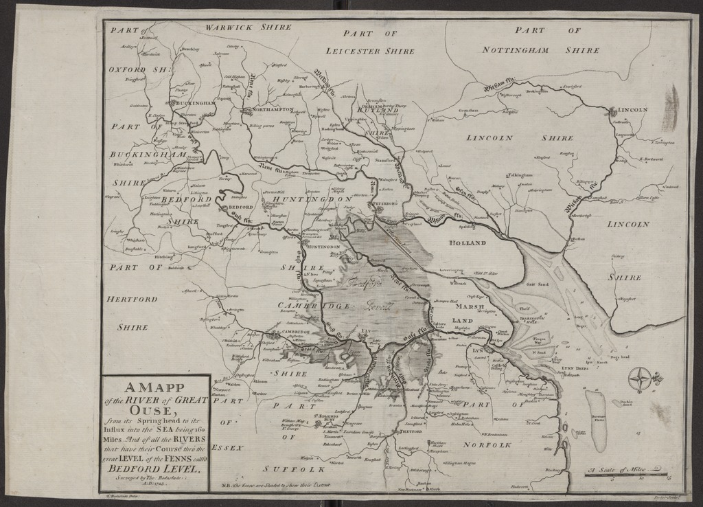
| dc.coverage.spatial | [1:450 000] A Scale of Miles, 15 [= 54 mm] | |
| dc.coverage.spatial | The Fens | |
| dc.coverage.spatial | Great Ouse | |
| dc.date.accessioned | 2016-03-11T19:34:27Z | |
| dc.date.available | 2016-03-11T19:34:27Z | |
| dc.date.copyright | 1725 | |
| dc.date.issued | 1725 | |
| dc.identifier.uri | https://ds.oszk.hu/xmlui/handle/123456789/93793 | |
| dc.description | Fokhálózat nélkül | |
| dc.description | Nyugati tájolás, irányrózsával | |
| dc.description | A közép-angliai Great Ouse folyó és a The Fenns mocsárvidék vízrajzi térképe | |
| dc.description | Teljes méret a kereten kívüli feliratokkal, a lemezhatárig: 31,8x39,1 cm | |
| dc.description | Megjelenési adatok külső források alapján | |
| dc.format.extent | 1 térkl. | |
| dc.format.medium | rézmetszet | |
| dc.format.medium | 30,8x38,1 cm | |
| dc.publisher | [T. Badeslade] | |
| dc.title | A MAPP of the RIVER of GREAT OUSE, from its Spring head to its Influx into the SEA being 160 Miles. - And of all the RIVERS that have their Course thro the great LEVEL of the FENNS called BEDFORD LEVEL. | |
| dc.title.alternative | Great Ouse, The Fens (vízrajzi térkép) (1723) | |
| dc.type | Cartographic | |
| dc.type | vízrajzi térkép | |
| dc.publication | [London] : [T. Badeslade], [1725] ([printed by J. Roberts, for the author] | |
| dc.identifier.collection | OSZK-2755414 | |
| dc.identifier.location | TR 1 038 | |