| dc.contributor | Faden, William (1750-1836) (metsző és közreadó) | |
| dc.contributor | Fisher, Joshua (1707-1783) (alapján) | |
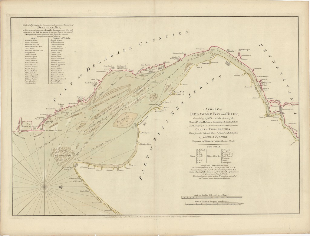
| dc.coverage.spatial | [1:220 000] Scale of English Miles 69 1/2 to a Degree, 20 [= 145 mm] | |
| dc.coverage.spatial | Delaware-öböl | |
| dc.date.accessioned | 2016-03-11T21:17:03Z | |
| dc.date.available | 2016-03-11T21:17:03Z | |
| dc.date.copyright | 1776 | |
| dc.date.issued | 1776 | |
| dc.identifier.uri | https://ds.oszk.hu/xmlui/handle/123456789/93997 | |
| dc.description | A Joshua Fisher felmerései alapján 1756-ban Philadelphiában készült és megjelent térkép 1775-ös változatának londoni, 1776-os, W. Faden által metszett és kiadott változata | |
| dc.description | Fokhálózat nélkül | |
| dc.description | Nyugati tájolású | |
| dc.description | Teljes kiadói felirat: London, Published according to Act of Parliament, March 12. 1776: by W. Faden, (Successor to the late M.r jefferys) Corner of St. Martins Lane, Charing Cross. | |
| dc.format.extent | 1 térkl. | |
| dc.format.medium | rézmetszet, kézi szín. | |
| dc.format.medium | 47,1x68,4 cm | |
| dc.publisher | published... by W. Faden | |
| dc.title | A CHART of DELAWARE BAY and RIVER, Containing a full & exact description of the Shores, Creeks, Harbours, Soundings, Shoals, Sands and Bearings of the most considerable Land Marks, from the CAPES to PHILADELPHIA. | |
| dc.title.alternative | Delaware-öböl (közlekedési térkép) (1776) | |
| dc.type | Cartographic | |
| dc.publication | London : published... by W. Faden, 1776 | |
| dc.identifier.collection | OSZK-1066563 | |
| dc.identifier.location | TR 1 794 | |