| dc.contributor | Jefferys, Thomas (1719?-1771) (közreadó) | |
| dc.contributor | Rycaut (rajz.) | |
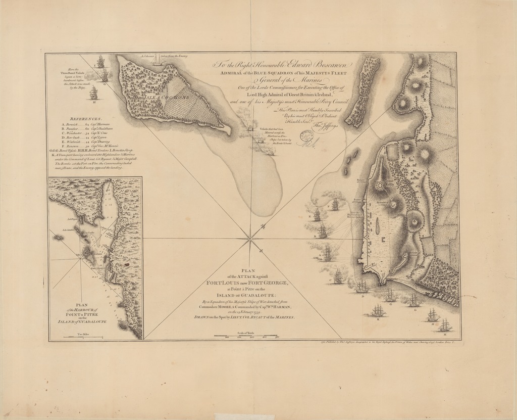
| dc.coverage.spatial | [1:6500] Scale of Yards, 500 [= 70 mm] | |
| dc.coverage.spatial | Pointe-a-Pitre | |
| dc.date.accessioned | 2016-03-11T23:10:20Z | |
| dc.date.available | 2016-03-11T23:10:20Z | |
| dc.date.copyright | 1760 | |
| dc.date.issued | 1760 | |
| dc.identifier.uri | https://ds.oszk.hu/xmlui/handle/123456789/94394 | |
| dc.description | Point-a-Pitre/Guadaloupe 1759. február 14-i angol ostromának térképe | |
| dc.description | Teljes kiadói felirat: 1760 Published by Tho.s Jefferys Geographer to his Royal Highness the Prince of Wales near Charing Cross London. Price 2 s. | |
| dc.format.extent | 1 térkl. | |
| dc.format.medium | rézmetszet | |
| dc.format.medium | 32x46 cm | |
| dc.publisher | published by Tho.s Jefferys | |
| dc.title | PLAN of the ATTACK against FORT LOUIS now FORT GEORGE, at Point à Pitre on the ISLAND OF GUADALOUPE: By a Squadron of his Majesty's Ships of War, detached from Commodore MOORE, & Commanded by Cap.t W.M HARMAN, on the 14 FEBRUARY 1759. | |
| dc.title.alternative | Pointe-a-Pitre (hadtörténelmi térkép) (1759) | |
| dc.type | Cartographic | |
| dc.type | ostromtérkép | |
| dc.publication | London : published by Tho.s Jefferys, 1760 | |
| dc.identifier.collection | OSZK-2632392 | |
| dc.identifier.location | TR 2 447 | |