


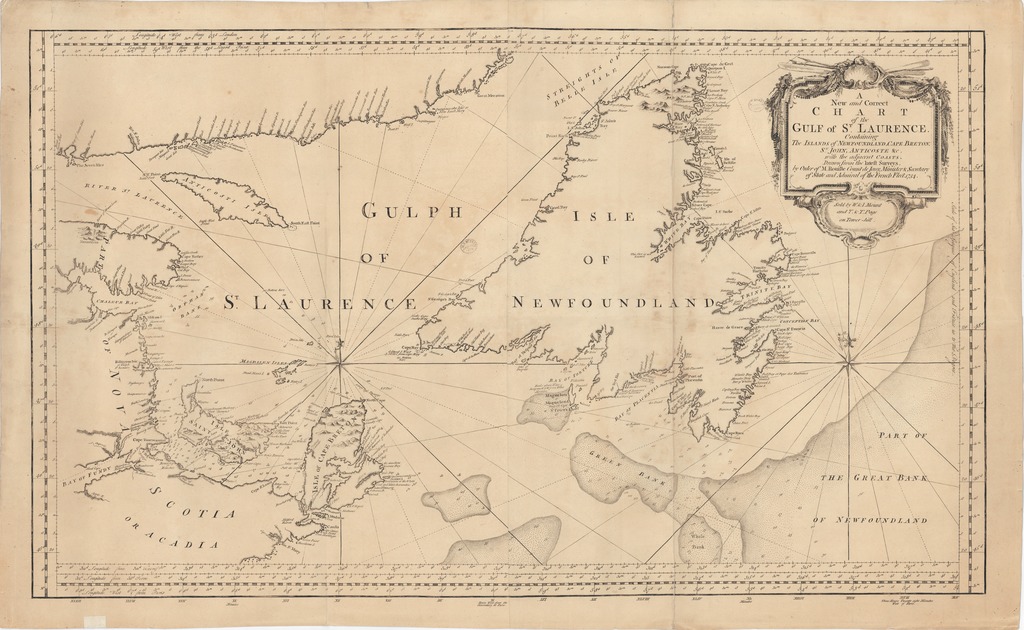
A New and Correct CHART of the GULF of ST. LAURENCE Containing The ISLANDS of NEWFOUNLAND, CAPE BRETON, S.T JOHN, ANTICOSTE &c. with the adjacent COASTS. - Drawn from the latest Surveys, by Order of M. Rouille Count de Jony, Minister & Secretary of State and Admiral of the French Fleet. 1754
Kapcsolódó földrajzi helyek
[1:1 500 000] Scale of Sea-Leagues of England and France 20 to the Degree, 20 [= 73 mm]Szent Lőrinc-öböl