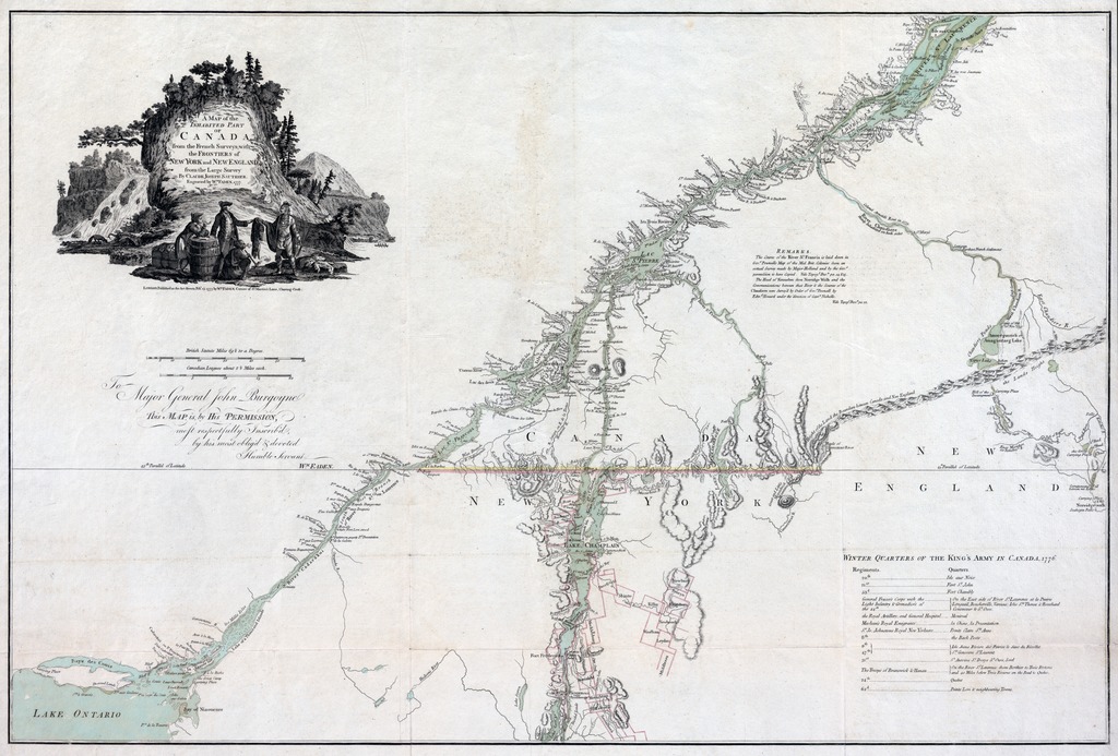
| dc.contributor | Sauthier, Claude Joseph (1736-1802) (kész.) | |
| dc.contributor | Faden, William (1750-1836) (metsző és közreadó) | |
| dc.coverage.spatial | [1:800 000] British Statute Miles 69 1/2 to a Degree, 60 [= 121 mm] | |
| dc.coverage.spatial | Szent Lőrinc-folyó vidéke | |
| dc.coverage.spatial | Champlaini-tó | |
| dc.date.accessioned | 2016-03-11T22:18:05Z | |
| dc.date.available | 2016-03-11T22:18:05Z | |
| dc.date.copyright | 1777 | |
| dc.date.issued | 1777 | |
| dc.identifier.uri | https://ds.oszk.hu/xmlui/handle/123456789/94471 | |
| dc.description | Ábrázolt terület: A Szt. Lőrinc folyó, Quebec déli és New York állam északi része | |
| dc.description | Földrajzi koordináta-adatok nélkül, csak a 45. szélességi fok vonala bejelölve | |
| dc.description | Teljes kiadói felirat, privilégiummal: LONDON, Published as the Act directs, Feb.r 25. 1777. by W.M FADEN, Corner of St. Martin's Lane, Charing-Cross. | |
| dc.format.extent | 1 térkl. | |
| dc.format.medium | rézmetszet, kézi szín. | |
| dc.format.medium | 56x84,5 cm | |
| dc.publisher | published... by W.m Faden | |
| dc.title | A MAP of the INHABITED PART OF CANADA from the French Surveys; with the FRONTIERS of NEW YORK and NEW ENGLAND from the Large Survey | |
| dc.title.alternative | Szent Lőrinc folyó és Champlain-tó (környék) (hadtörténelmi térkép) (1777) | |
| dc.type | Cartographic | |
| dc.type | hadműveleti térkép | |
| dc.publication | London : published... by W.m Faden, 1777 | |
| dc.identifier.collection | OSZK-1066378 | |
| dc.identifier.location | TR 2 799 | |