Pannon Digital Joint Archives
Toggle navigation
English
Deutsch
magyar
English
English
Deutsch
magyar
Login
Toggle navigation
View Item
DSpace Home
Feldolgozás alatt
Országos Széchényi Könyvtár
Térképtár (archív)
1850 előtt nyomtatott térképek (TR jelzetek)
View Item
DSpace Home
Feldolgozás alatt
Országos Széchényi Könyvtár
Térképtár (archív)
1850 előtt nyomtatott térképek (TR jelzetek)
View Item
JavaScript is disabled for your browser. Some features of this site may not work without it.
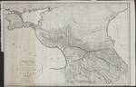
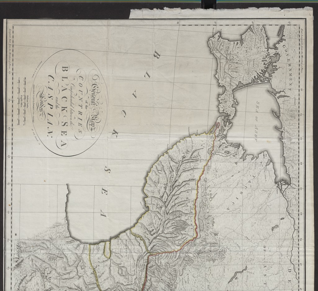
General Map of the COUNTRIES Comprehended between the BLACK SEA and the CASPIAN
Date
1788
Author
Neele, Samuel John (1758-1824) (metsző)
Edwards, J. (közreadó)
Spatial coverage
[1:1 420 000] Russian Versts, 130 [= 98 mm]
Kaukázus-vidék
Location / Jelzet
TR 2 988
Metadata
Show full item record
View/
Open
TR_02988_R1_1024.jpg (520.2Kb)
TR_02988_R2_1024.jpg (569.4Kb)
TR_02988_1024.jpg (236.5Kb)
URI
https://ds.oszk.hu/xmlui/handle/123456789/94540
Collections
1850 előtt nyomtatott térképek (TR jelzetek)
Search DSpace
This Collection
Browse
All of DSpace
Communities & Collections
By Issue Date
Authors
Titles
Subjects
This Collection
By Issue Date
Authors
Titles
Subjects
My Account
Login


