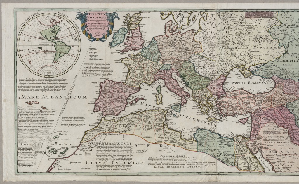
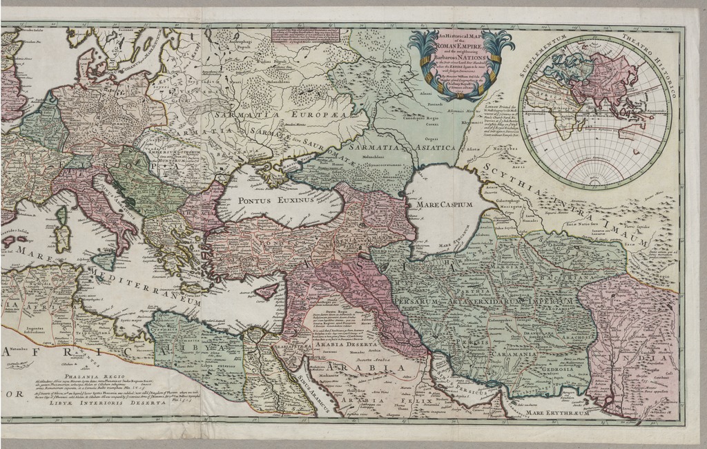
An Historical Map of the Roman Empire and the neighbouring Barbarous NATIONS to the Year of Our Lord Four Hundred, when the EMPIRE began to be rent with foreign Invasions
THEATRUM HISTORICUM ad annum Christi quadringentesimū in quo tum IMPERII ROMANI tum BARBARORUM circumincolentium status ob oculos ponitur - auctore Guillelmo Del'Isle e Regia Scientiarum Academia Parisiis
| dc.contributor | L'Isle, Guillaume de (1675-1726) (kész.) | |
| dc.contributor | Moll, Hermann (ca. 1655-1732) (közreadó) | |
| dc.contributor | Midwinter, Daniel (közreadó) | |
| dc.contributor | Davis, Richard (közreadó) | |
| dc.coverage.spatial | [1:8 200 000] Stadia Græca quorum 600 uni Gradui respondent, 2000 [=45 mm] | |
| dc.coverage.spatial | Európa | |
| dc.coverage.spatial | Nyugat-Ázsia | |
| dc.coverage.spatial | Észak-Afrika | |
| dc.date.accessioned | 2016-03-11T23:48:30Z | |
| dc.date.available | 2016-03-11T23:48:30Z | |
| dc.date.copyright | 1709 | |
| dc.date.issued | 1709 | |
| dc.identifier.uri | https://ds.oszk.hu/xmlui/handle/123456789/94605 | |
| dc.description | G. de L'Isle 1705-ben Párizsban megjelent térképének londoni, angol feliratokkal kiegészített kiadása | |
| dc.description | Teljes kiadói felirat: London Printed for H. Moll Geographer, D. Midwinter at ye 3 Crowns in St. Pauls Church Yard, Ri. Davies at ye 3 Ink Bottles in Castele Alley on ye West end of ye Royal Exchange, and over against Devereux Court, without Temple Bar. | |
| dc.format.extent | 1 térkl. | |
| dc.format.medium | rézmetszet, kézi szín. | |
| dc.format.medium | 47x116 cm | |
| dc.publisher | printed for H. Moll : | |
| dc.publisher | D. Midwinter : | |
| dc.publisher | Ri. Davies | |
| dc.title | An Historical Map of the Roman Empire and the neighbouring Barbarous NATIONS to the Year of Our Lord Four Hundred, when the EMPIRE began to be rent with foreign Invasions | |
| dc.title | THEATRUM HISTORICUM ad annum Christi quadringentesimū in quo tum IMPERII ROMANI tum BARBARORUM circumincolentium status ob oculos ponitur - auctore Guillelmo Del'Isle e Regia Scientiarum Academia Parisiis | |
| dc.title.alternative | Európa, Nyugat-Ázsia, Észak-Afrika (történelmi térkép) (IV. sz.) | |
| dc.type | Cartographic | |
| dc.type | történelmi térkép | |
| dc.publication | London : printed for H. Moll : D. Midwinter : Ri. Davies, 1709 | |
| dc.identifier.collection | OSZK-2724559 | |
| dc.identifier.location | TR 3 052 |