| dc.contributor | Badeslade, Thomas (aktív 1712-1745) (kész. és közread.) | |
| dc.contributor | Parker, Samuel (metsz.) | |
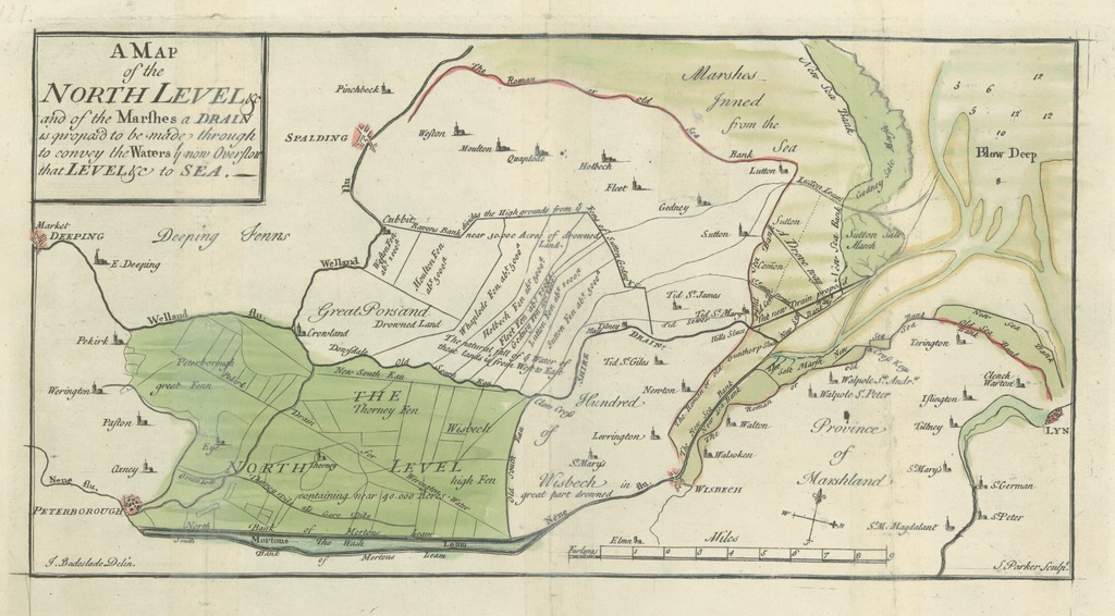
| dc.coverage.spatial | [1:175 000] 9 miles [= 82 mm] | |
| dc.coverage.spatial | The Fens | |
| dc.date.accessioned | 2016-03-11T23:03:49Z | |
| dc.date.available | 2016-03-11T23:03:49Z | |
| dc.date.copyright | 1725 | |
| dc.date.issued | 1725 | |
| dc.identifier.uri | https://ds.oszk.hu/xmlui/handle/123456789/94644 | |
| dc.description | Fokhálózat nélkül | |
| dc.description | A kelet-angliai The Fenns mocsárvidék északi részének lecsapolási javaslata | |
| dc.description | Készítési és kiadási adatai külső források alapján | |
| dc.format.extent | 1 térkl. | |
| dc.format.medium | rézmetszet, kézi szín. | |
| dc.format.medium | 15,4x29,6 cm | |
| dc.publisher | [printed by J. Roberts, for the author] | |
| dc.title | A MAP of the NORTH LEVEL &c and of the Marshes a DRAIN is propos'd to be made through to convey the Waters ty now Overflow that LEVEL &c to SEA | |
| dc.title.alternative | The Fens (vízrendezési térkép) (1725) | |
| dc.type | Cartographic | |
| dc.type | vízrendezési térkép | |
| dc.type | topográfiai térkép | |
| dc.publication | [London] : [printed by J. Roberts, for the author], [1725] | |
| dc.identifier.collection | OSZK-2754363 | |
| dc.identifier.location | TR 372 | |