Pannon Digital Joint Archives
Toggle navigation
English
Deutsch
magyar
Deutsch
English
Deutsch
magyar
Einloggen
Toggle navigation
Dokumentanzeige
DSpace Startseite
Feldolgozás alatt
Országos Széchényi Könyvtár
Térképtár (archív)
1850 előtt nyomtatott térképek (TR jelzetek)
Dokumentanzeige
DSpace Startseite
Feldolgozás alatt
Országos Széchényi Könyvtár
Térképtár (archív)
1850 előtt nyomtatott térképek (TR jelzetek)
Dokumentanzeige
JavaScript is disabled for your browser. Some features of this site may not work without it.
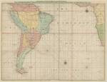
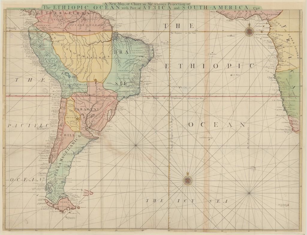
A New Map, or Chart in Mercators Projection of he ETHIOPIC OCEAN with Part of AFRICA and SOUTH AMERICA 1740
Datum
1740
Autor
Senex, John (1678-1740) (kész. és közreadó)
Spatial coverage
[1:12 000 000] A Scale of Leagues 20 to a Degree, 100 [= 47 mm]
Atlanti-óceán
Location / Jelzet
TR 1 894
Metadata
Zur Langanzeige
Öffnen
TR_01894_1024.jpg (320.4Kb)
URI
https://ds.oszk.hu/xmlui/handle/123456789/94054
Collections
1850 előtt nyomtatott térképek (TR jelzetek)
DSpace Suche
In dieser Sammlung
Stöbern
Gesamter Bestand
Bereiche & Sammlungen
Erscheinungsdatum
Autoren
Titeln
Schlagworten
Diese Sammlung
Erscheinungsdatum
Autoren
Titeln
Schlagworten
Mein Benutzerkonto
Einloggen


