| dc.contributor | W. & J. Mount & T. & T. Page (London) (közreadó) | |
| dc.coverage.spatial | [1:1 500 000] Scale of Sea-Leagues of England and France 20 to the Degree, 20 [= 73 mm] | |
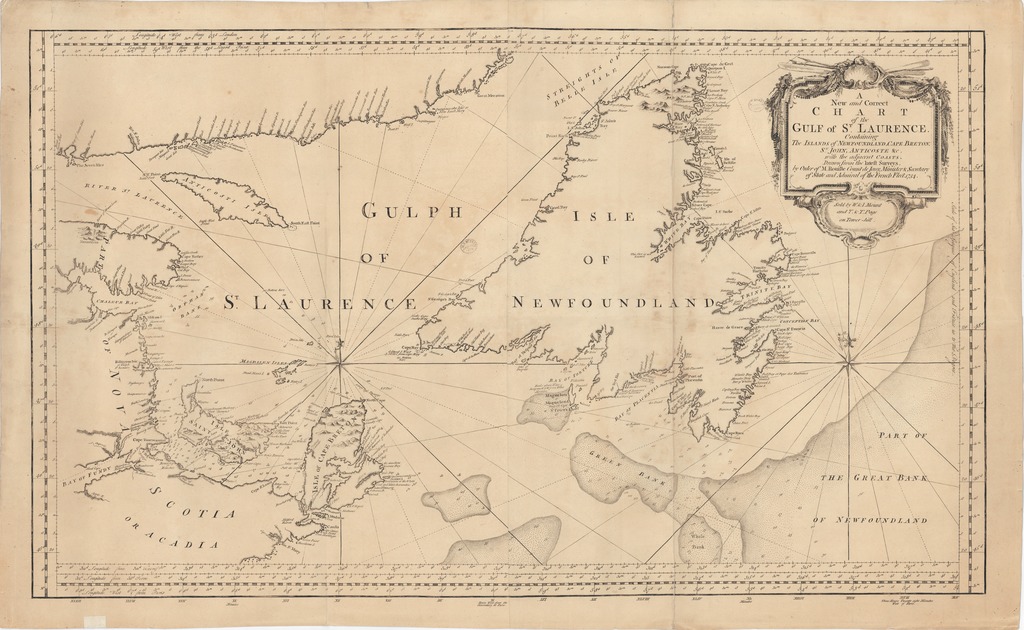
| dc.coverage.spatial | Szent Lőrinc-öböl | |
| dc.date | [1754-1755] | |
| dc.date.accessioned | 2016-03-11T20:06:32Z | |
| dc.date.available | 2016-03-11T20:06:32Z | |
| dc.identifier.uri | https://ds.oszk.hu/xmlui/handle/123456789/94445 | |
| dc.description | Mágneses elhajálás bejelölve az 1750. évi értékkel | |
| dc.description | Teljes méret külső keretig: 52x87,5 cm ; a ketreten kívüli feliratokkal, lemezhatárig: 54x93 cm | |
| dc.description | Teljes kiadói felirat: Sold by W. & I. Mount and T. & T. Page on Town-hill. | |
| dc.format.extent | 1 térkl. | |
| dc.format.medium | rézmetszet | |
| dc.format.medium | 47x82,8 cm | |
| dc.publisher | sold by W. & I. Mount and T. & T. Page | |
| dc.title | A New and Correct CHART of the GULF of ST. LAURENCE Containing The ISLANDS of NEWFOUNLAND, CAPE BRETON, S.T JOHN, ANTICOSTE &c. with the adjacent COASTS. - Drawn from the latest Surveys, by Order of M. Rouille Count de Jony, Minister & Secretary of State and Admiral of the French Fleet. 1754 | |
| dc.title.alternative | Szent Lőrinc-öböl (közlekedési térkép) (1754) | |
| dc.type | Cartographic | |
| dc.type | hajózási térkép | |
| dc.publication | [London] : sold by W. & I. Mount and T. & T. Page, [1754-1755] | |
| dc.identifier.collection | OSZK-2525947 | |
| dc.identifier.location | TR 2 570 | |